Last week, I wrote three blog posts about the involvement of Quakers in various phases of the White-supremacist settler-colonial project here in Turtle Island (the United States.) But all those phases were after the allocation by England’s King Charles II of a huge chunk of land in Turtle Island to the Quaker William Penn, which happened in 1681 CE. Those posts covered, respectively, that English royal land grant to W. Penn; the involvement of Quakers from Baltimore Yearly Meeting (BYM) in various “pacification”-like activities towards Native Americans in the period 1795-1877; and my first, raw reflection on how a “settler of conscience” might best act to dismantle, rather than reform, a system of White-supremacist settler colonialism.
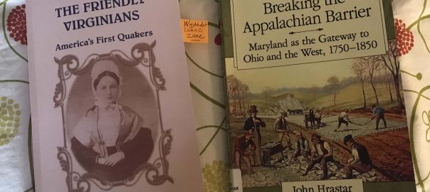
Since then, I’ve done more reading and reflecting on these issues. In particular, reading these books:
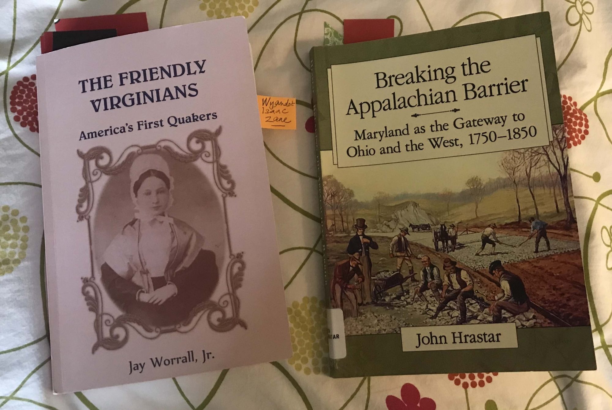
Both are extremely well documented, well written, and informative. I’d read Jay Worrall’s book before. Jay was a pillar of our Quaker meeting in Charlottesville, whose record as a transformational social activist (especially after he left the military… ) was one that I deeply admired. He died aged 94, in 2010. In the months before that I would try to visit him once a week; and I had even started doing a reading-out-loud from his book to him but he died before we could get very far at all.
My current re-read of Friendly Virginians (FV), alongside my reading of Hrastar’s Breaking the Appalachian Barrier (BAB) has helped me gain increased understanding of the pre-Penn period of Quakerism in Turtle Island as well as of the deep involvement of many Quakers in pre- and post-1776 projects to expand the settler presence considerably west of the Blue Ridge Mountains– a line that I had earlier, mistakenly, thought had been established by the English/British authorities as a pretty firm limit on the settlers’ activities.
So here’s some of what I’ve been learning:
1. There were Quaker settlers in Virginia and Maryland long before Penn got his land grant
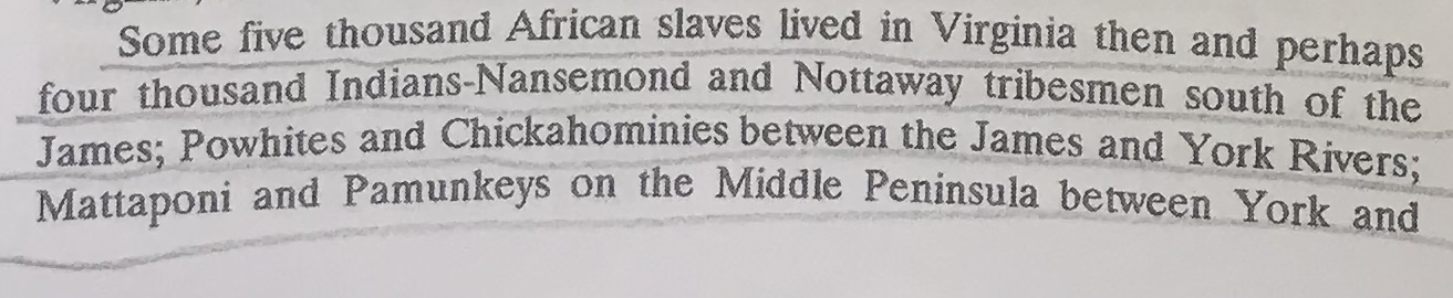
As FV makes clear (and I should have remembered… ) the first Quaker groups in Turtle Island arose from conversion efforts undertaken in the south of the Virginia colony in 1655 by, primarily, an energetic Quaker missionary from London called Elizabeth Harris. Those Quakers were “dissenters” from the Anglicanism that dominated most of the still very young Virginia colony, but they were more or less permitted to pursue their Quaker way of worship. FV tells us (p.5) that:
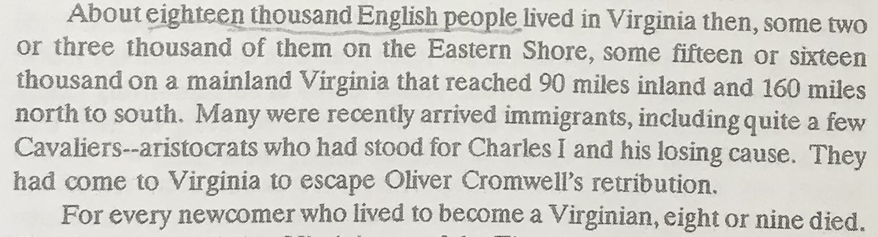
That area of colonial settlement was primarily along the James River, which is in the south of today’s Virginia. FV also tells us, pp. 5-6, that…
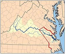
It’s worth recalling that for several decades earlier, the Powhatans had battled the Virginia settlers quite valiantly; but in 1646 they were finally vanquished by the settler mobs and had been forced to sign a peace treaty. Under that treaty, the red line shown here was the agreed limit of the colonial settlement and members of both parties were forbidden from crossing the line without the express permission of the other party. (Good luck with that, Native Americans!)
The red-lined zone covers a tiny portion of the south-east of today’s Virginia and a sliver of today’s North Carolina. Current state lines are in black and the thick snaking blue line is the James River.
… So, from 1655 on, there were small groups of Quakers in southern Virginia; and at different times their anti-clerical mode of worship and other practices were suppressed, or on occasion the suppression was lifted to different degrees. Some of them traveled further north up the Chesapeake Bay and settled in Maryland, whose English-Catholic governors were more tolerant than the Anglicans of their hetrodoxy. And in 1672, the founder of Quakerism, George Fox, himself visited some of the Quaker communities in Maryland during a trip that also took him to Barbados.
In both those places Fox saw settlers– including, at least in Barbados but possibly also in Maryland, Quaker settlers— who were engaged in slave-holding and slave-working. In his journal and letters, he expressed a generally approving/colluding attitude toward the institution of slavery; and I’ve read nothing at all from him or about him indicating that he critiqued the practice of settler-colonial land grabbing.
But anyway, just to note that those Quaker settlements along the banks and many inlets of the Chesapeake Bay antedated the large 1681 royal land grant that brought thousands of Quakers to “Penn”-sylvania, by a quarter century.
2. Quakers were among the first settlers to establish colonies west of the Blue Ridge
Jay Worrall’s excellent book gives many details about the growth of the colony of Virginia. Many of the “land grants” or “patents” that the English monarchs (or briefly there, Cromwell) gave to the private companies that established colonies in North America provided these “patents” “from sea to sea”. That was the case for Virginia, whose leaders could, per their “grant” from the English king, plan to establish settlements as far west as they wanted, until they should reach the Pacific. The line established by the 1646 treaty did not hold for long!
FV tells us (p.124) about a decision the governing council of the Virginia settlers, the “Burgesses”, took in 1701:
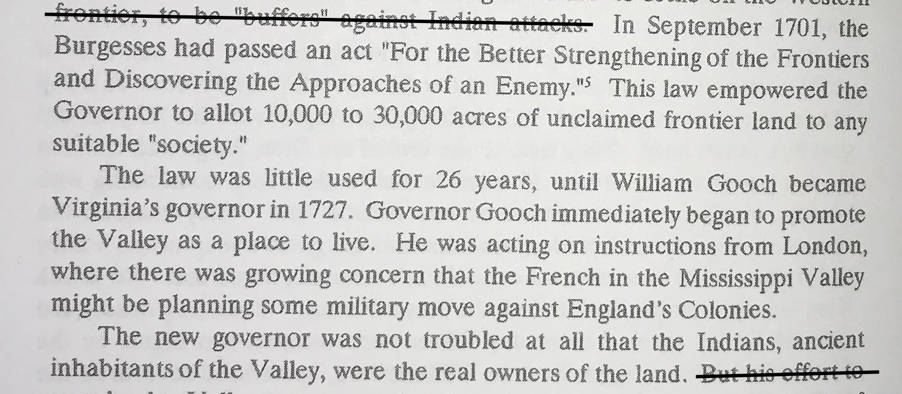
That Valley, by the way, was the Shenadoah Valley, which lies to the west of the Blue Ridge mountains. So then this happened (p.125):

These grants, FV continues, went to different sets of Quaker settler/investors, most of whom were then residing in the burgeoning Quaker settlements in Pennsylvania and New Jersey, which abut the Shenadoah to the north. But those guys still had to obtain their grants from the Virginia capital, in Williamsburg. They were:
- One partnership of two Quakers who were granted 100,000 acres, just north of today’s Winchester, VA.
- Another partnership who got a grant of 100,000 acres a little to the south of that, and then they also bought 40,000 more acres.
- A less “successful” partnership of Quakers who got 14,000 acres yet further to the south.
- A single, very ambitious Quaker from New Jersey who got a grant of 99,129 acres near present-day Lexington.
So the Quaker investors who had successfully “bought” these low-costs tracts of land then set about putting settlers onto them. Many but not all of the settlers who came into those tracts were Quakers (Friends). Most of them traveled down from Pennsylvania. The trails from there were hard to get along– but still, a lot easier to traverse than Virginia’s own forbidding Blue Ridge Mountains.
Worrall wrote that the Shenandoah Valley, once the new settlers had entered it, “was and is a kind of Eden. The land was open and park-like; for the Indians had periodically burned it over to make hunting easier. Great mountains loomed blue on either side, east and west.” Every single assertion he makes there on p.126 seemed very well documented. (The emphasis, though, is mine.)
He continued (p.127):
A little later, pp. 129-30, he writes:
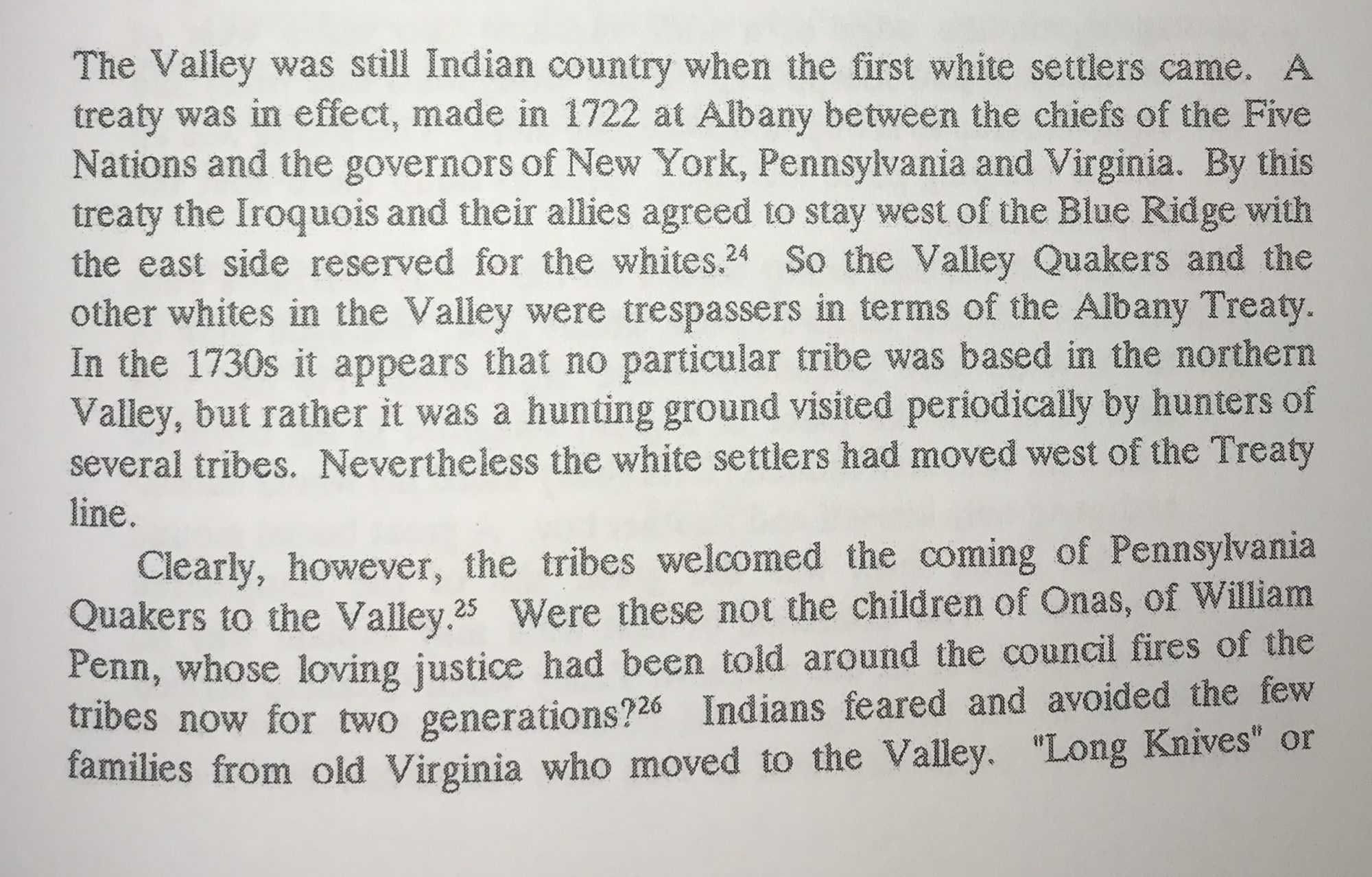
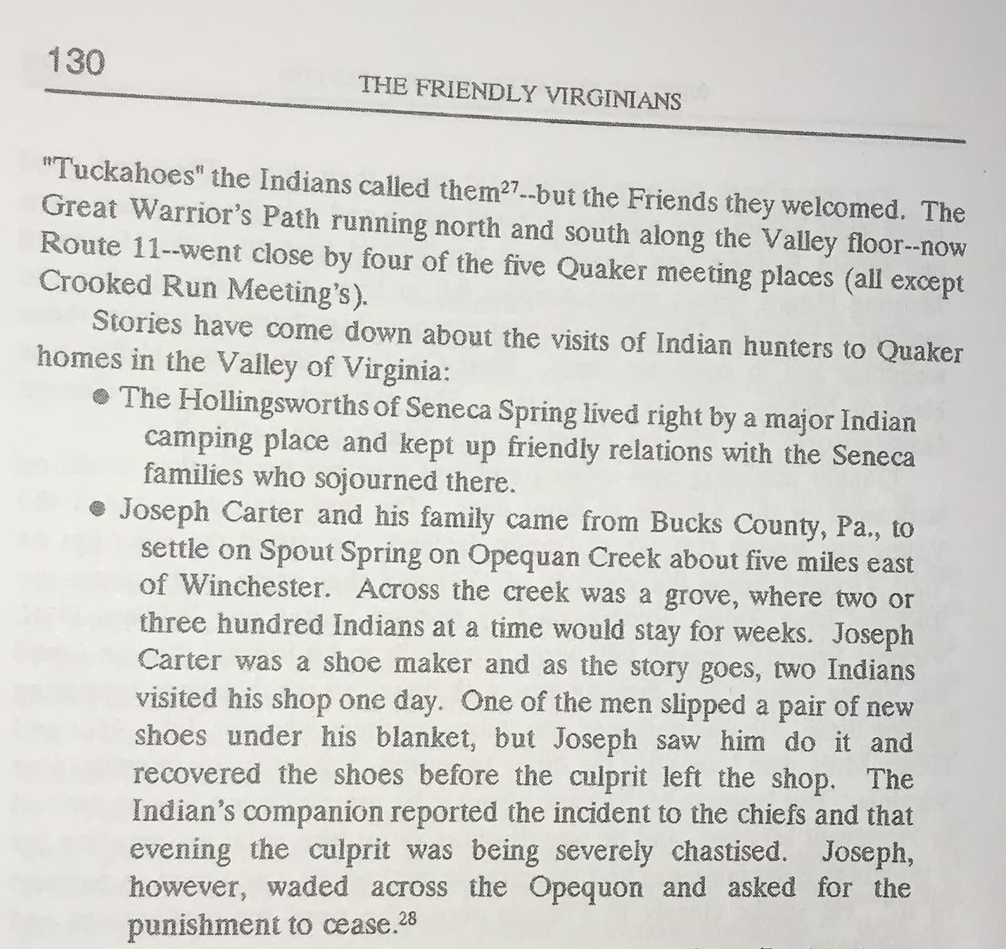
(A couple more similar stories of peaceful coexistence follow.)
Worrall’s very well-documented account seem at odds with what M.C. Catlin wrote in her more recent book, As They Were Led. She wrote of Quakers who “migrated to” the Opequan area of the Shenandoaah Valley that, “Not finding current Native residents, nor any claims to ancestral lands from those who followed the ancient… trade route through their settlements, they found themselves in abrogation of a strongly held principle of the Society [of Friends]… ” Catlin’s sole source there (fn. 23, p.12) was a historical study of Quaker settlement much further to the south, in North Carolina.
Anyway, I was glad to be reminded in Worrall’s book of the origins of the Quaker meetings in the Shenandoah Valley; and of the often rich nature of the interactions the early Quaker settlers there had with the Native Americans who had long lived, hunted– and most likely also done some farming– there.
3. Quakers then contributed a lot to the settlers’ continued westward expansion, into the Ohio Valley
Back when I first read Friendly Virginians— 2005 or so– I used to joke with Jay Worrall that, heck, it looked as if just about everybody with a known name in U.S.history had been descended in one way or another from Virginian Quakers! True of Daniel Boone, true of Abraham Lincoln, true of the Lynch brother– of Lynchburg fame, and also “lynching”: yes, you read that right…
So in reading John Hrastar’s Breaking the Appalachian Barrier: Maryland as the Gateway to Ohio and the West, 1750-1850, I came across the name of someone with the family name Zane, and I thought, h’mmm, sounds familiar…
But first, let me backtrack to a quick recap as to why breaking the “barrier” of the Appalachian mountains was such a big deal. Back then, in the early years of White-supremacist settler colonialism worldwide, traveling by water and the establishment of stable waterborne trade routes was all-important for trade, development, and colonial expansion. It was land travel that was hard.
By 1700, the English had established settlements up all the eastern coast of North America from the northern edge of Florida (held by the Spanish) to the north edge of Nova Scotia (north of which the French had access to the St. Lawrence system.) The English colonies controlled some enormous watersheds– for the Susquehanna/Chesapeake system, the Delaware River system, and the Hudson River system. But they didn’t have massive expanses of fertile land. The land they had in, e.g., Maryland, Virginia and the Carolinas could only host profitable settler-run farms if those farms were worked by enslaved labor. (And profitability was everything!)
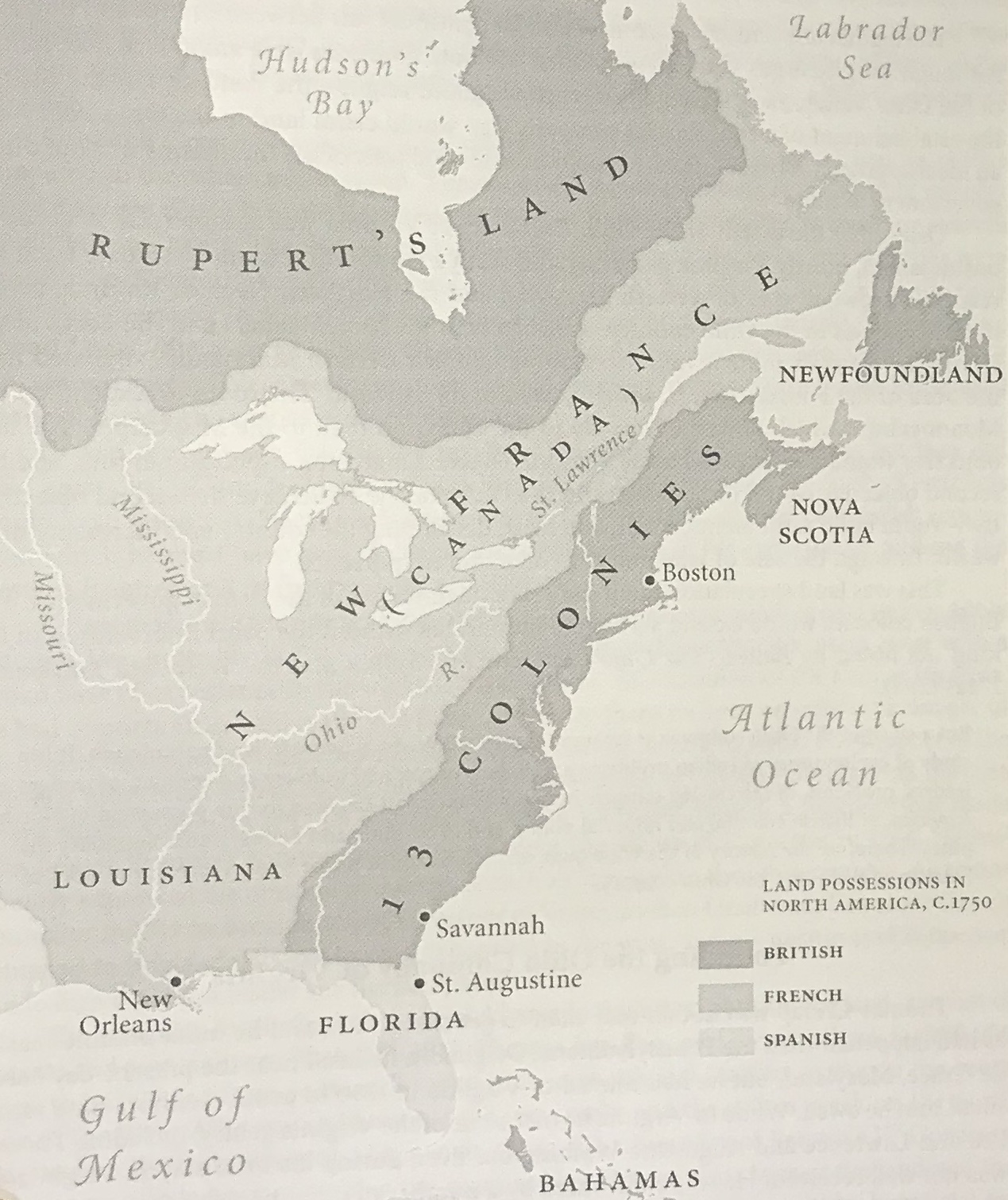
The French, by contrast, controlled– to some extent– two great river systems that between them cut right across the continent, north to south: the St. Lawrence/Great Lakes system in the north and the massive Mississippi basin that drained a huge watershed to the south. The Mississippi and its tributaries snaked through broad, flat areas that could potentially be used for very profitable extractive cultivation, though the French generally were less interested in planting large colonial settlements there than in trading profitably with the large Indigenous populations of the those areas. The ridges of the Appalachian mountains divided the English colonies from the Mississippi watershed– specifically, from the Ohio River and its tributaries, which on a flat map looked very close to some of the headwaters of the Potomac or, in western Pennsylvania/Maryland/Virginia.
But of course, the land itself was far from flat, so the goal of the English settlers, generally backed by the monarch in London and the governors of the colonies, was to find ways to establish stable communications between, especially, the navigable parts of those two river systems…
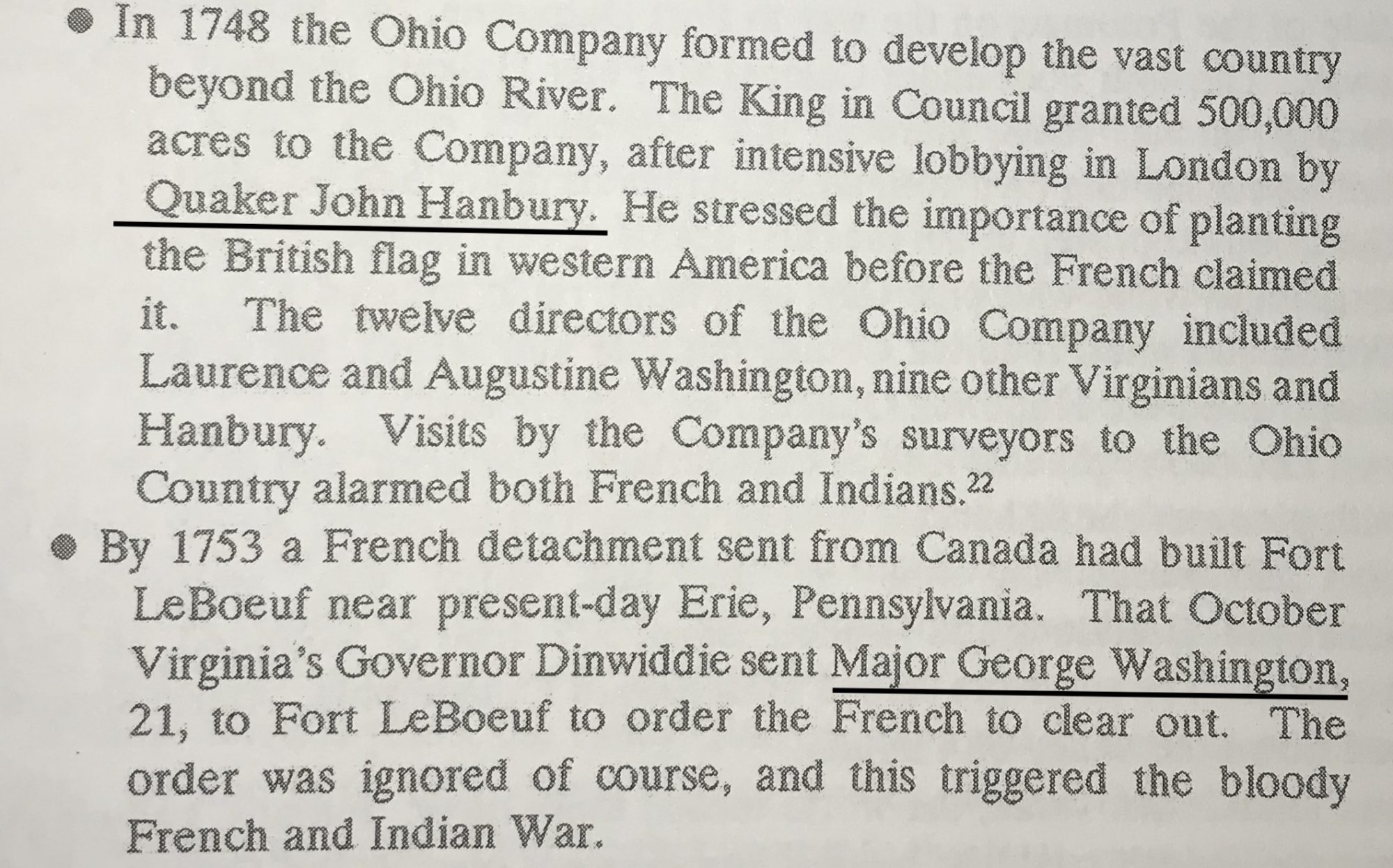
In 1748, the French and English had reached a peace treaty at Aix-La-Chapelle in which they agreed to return the situation in North America to the status quo ante. But it seems clear from my reading of both Hrastar and Worrall that, especially in the Ohio River valley, they could not agree on what that status quo ante had been. So that same year, the English authorities chartered a new, private-sector colony-building company to invest in establishing English settlements in “Ohio”. Look who was the biggest person lobbying for the establishment of that company… and look who was the (very young) English military man sent to challenge the French presence in the area.
Worrall p.153:
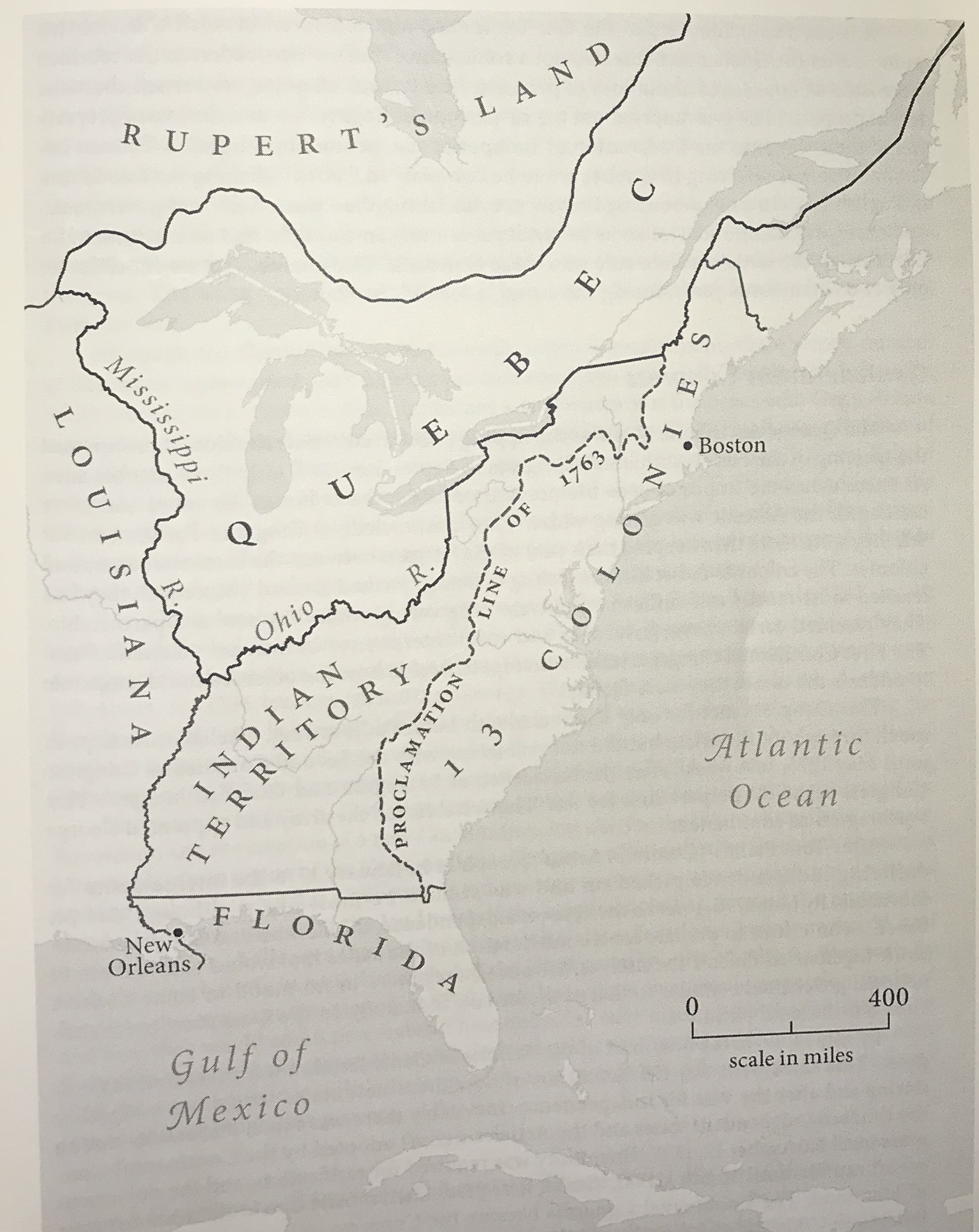
In that war, essentially, the British beat the French and the map that resulted from the 1774 Quebec Act was as shown (Hrastar, p.123.) That “Quebec” was British-controlled. The French had been reduced to the area of “Louisiana” west of the Mississippi. And look! There was something there marked “Indian Territory”! Do you think the Native Americans actually got to enjoy some sovereignty there? Dream on. In and around 1776, as you may recall, there was an uprising against the British launched by the settlers who had benefited for more than 150 years by then from the military might, arrant land-theft, and colony-building policies of the government in London. And guess who got stuck in the middle of that– geographically, and politically? The Native Americans….
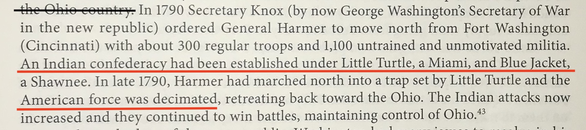
Mainly, and unsurprisingly, the Native resisters were opposed to the settlers. Hrastar’s book (134-36) has a pretty good description of what happened during what the American settler regime would later come to call the “Ohio Indian Wars”.
In 1790, this happened: (Hrastar, 135)
The next year, the settler regime tried again (ibid.):
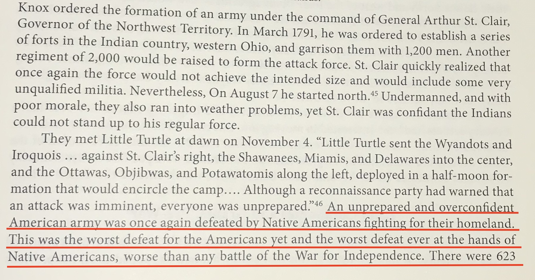
(continued on p.136):

In 1792, “President” George Washington assigned a new commander to the U.S. “Northwest” zone. It was a guy who came to be called “Mad Anthony Wayne”. Hrastar, 136: “His job continued to be the protection of Ohio settlers.”
Then this:
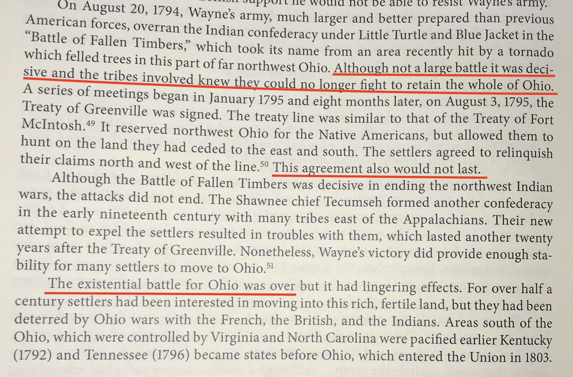
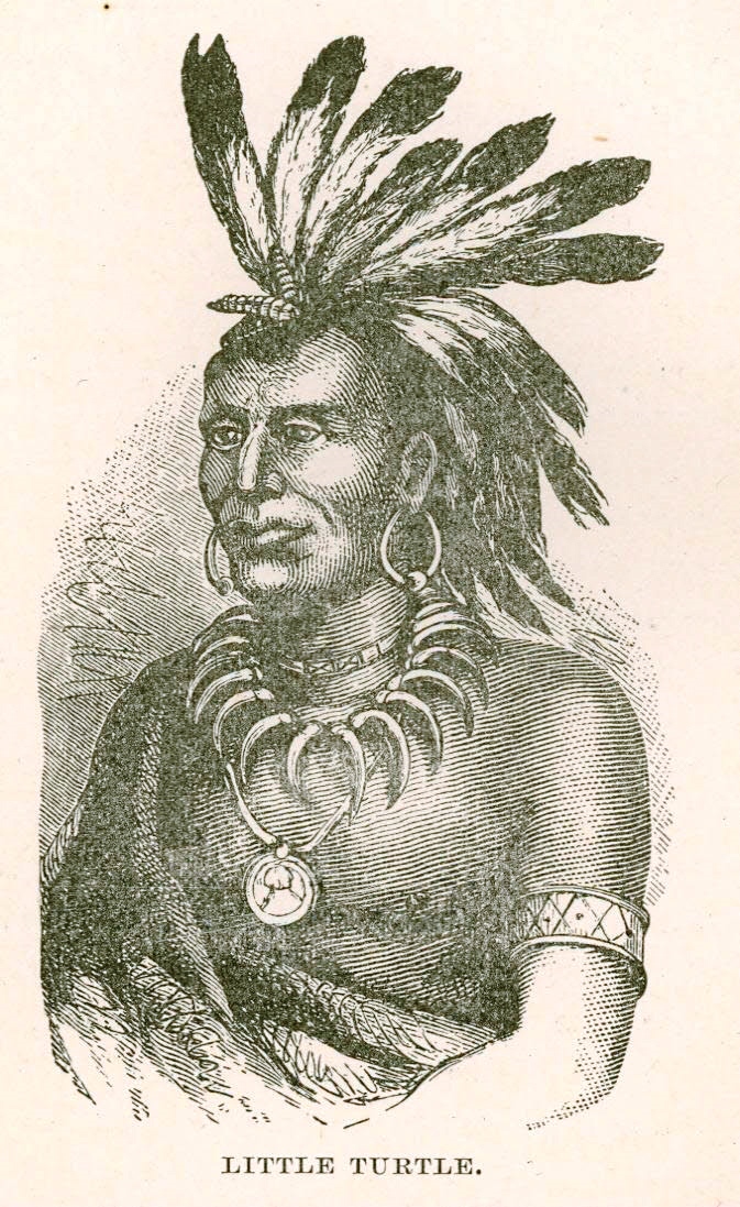
Wow. Altogether quite a story, and one I did not know until now. Little Turtle and Blue Jacket tried so valiantly to protect their lands! In M.C. Catlin’s book about the activities of BYM’s Indian Affairs Committee, Little Turtle appears frequently in the post-1795 period she covers– but nearly always as either a cultural oddity or a supplicant. He was clearly a whole lot more than that.
The Baltimore Yearly Meeting of the Religious Society of Friends had formed its Indian Affairs Committee in 1795, the precise same year that the resistance of most of the Indigenous Nations of the Ohio region had been quelled. (In the years before 1795, when George Washington’s armies were brutally quelling the Indians, did BYM undertake any campaigns to challenge or end that militaristic aggression against the Indians? I have seen no record of that.)
… But okay, back to the Zane family, which does tie a lot of the above narrative together. Hrastar tells us, pp. 175-76, that,
The family of Ebenezer Zane (1747-1812) and his two brothers, Silas and Jonathan originally resided on the South Branch of the Potomac… Although we do not know they made their wealth, they were not poor and they owned slaves. In 1769, when Ebenezer was twenty-two, the three brothers and their slaves, as well as several neighbors… moved to the area near the mouth of Wheeling Creek on the east bank of the Ohio. A year after the [1784] Treaty of Fort Stanwix which opened settlement up to the eastern shore of the Ohio, they established the first white settlement in the area, known as Zanesburg.
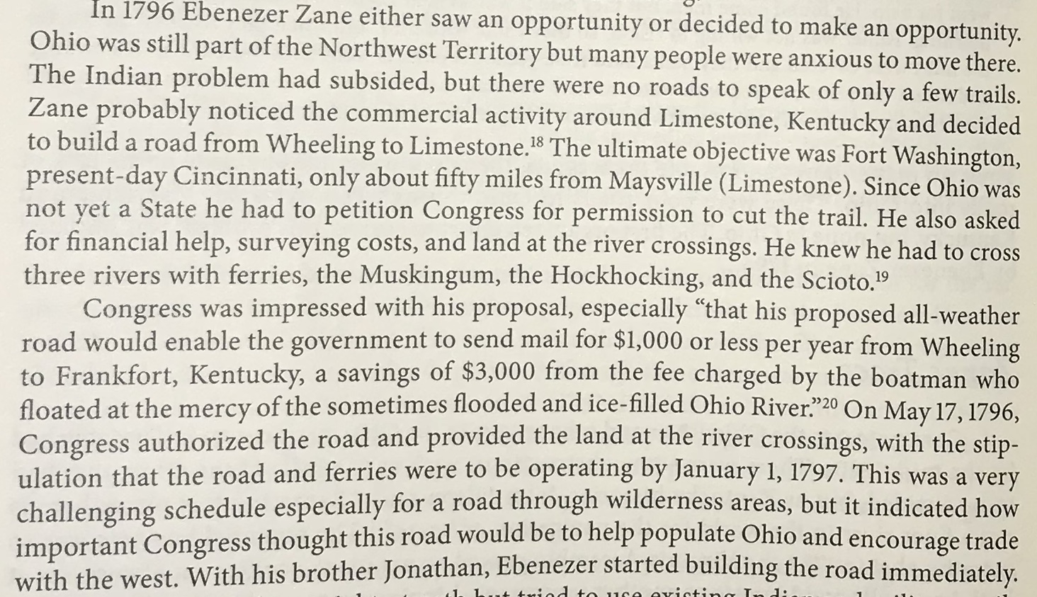
Hrastar tells us that Zane fought in the Revolutionary War. And then, in 1796, he saw an opportunity:
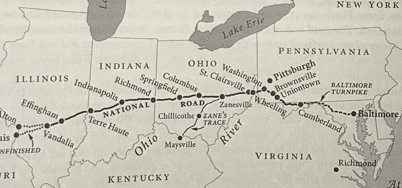
And here, from Hrastar p.202, is the map. The original trail that Zane established went from Wheeling to Maysville (aka Limestone.) The Wheeling to Zanesville portion was later incorporated into what became known as the “National Road”.
… Well, maybe you guessed where this is all going? Ebenezer Zane, activist leader in the colonial expansion project, probable slave-“owner”, and fighter in the Revolutionary War was… a Quaker.
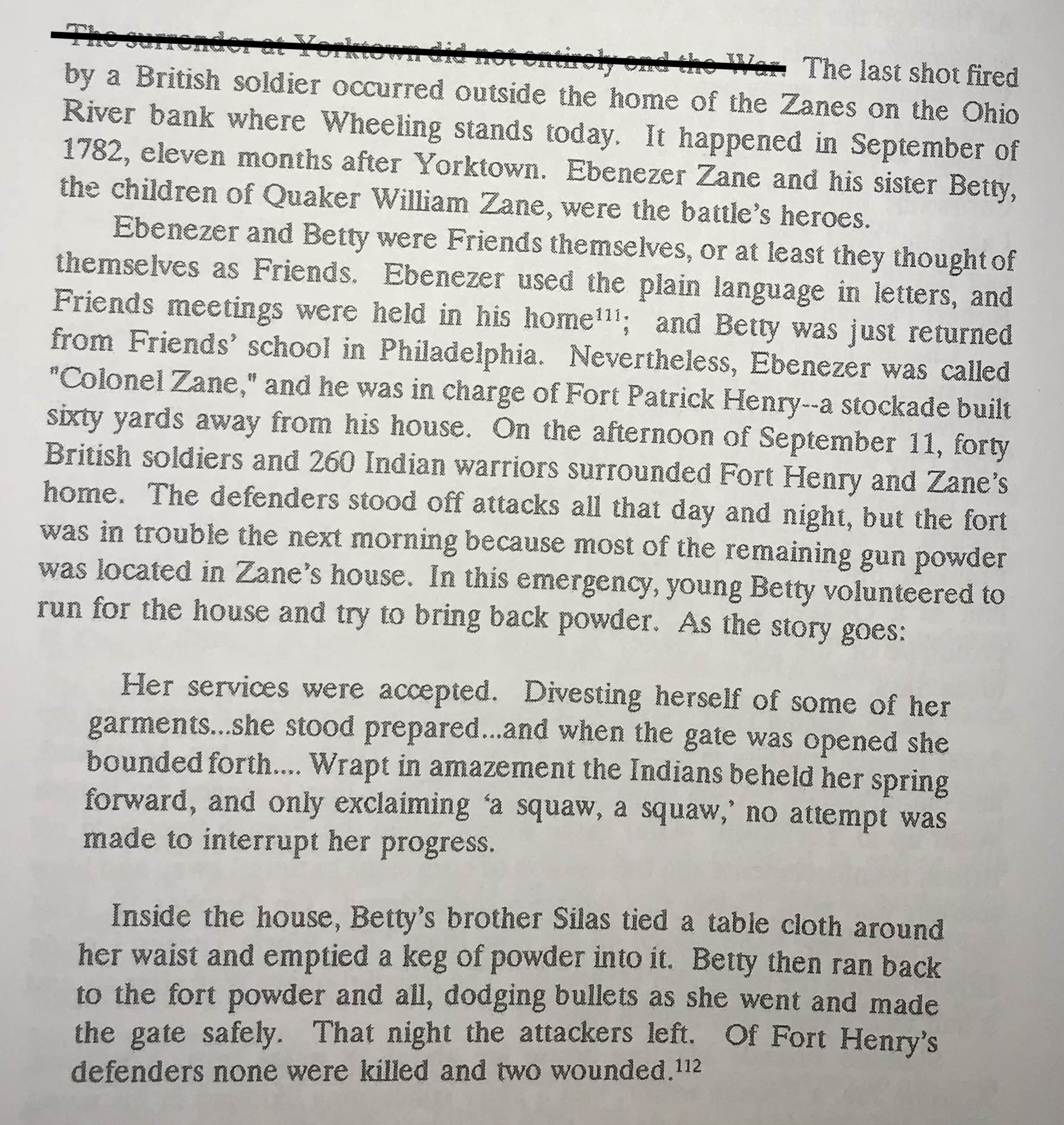
Jay Worrall had quite a few references to the Zane family in Friendly Virginians. He confirmed that Ebenezer considered himself a Quaker, and tells that he and his sister Betty took a notable part in the very last battle the American insurgents waged against the British, in 1782:
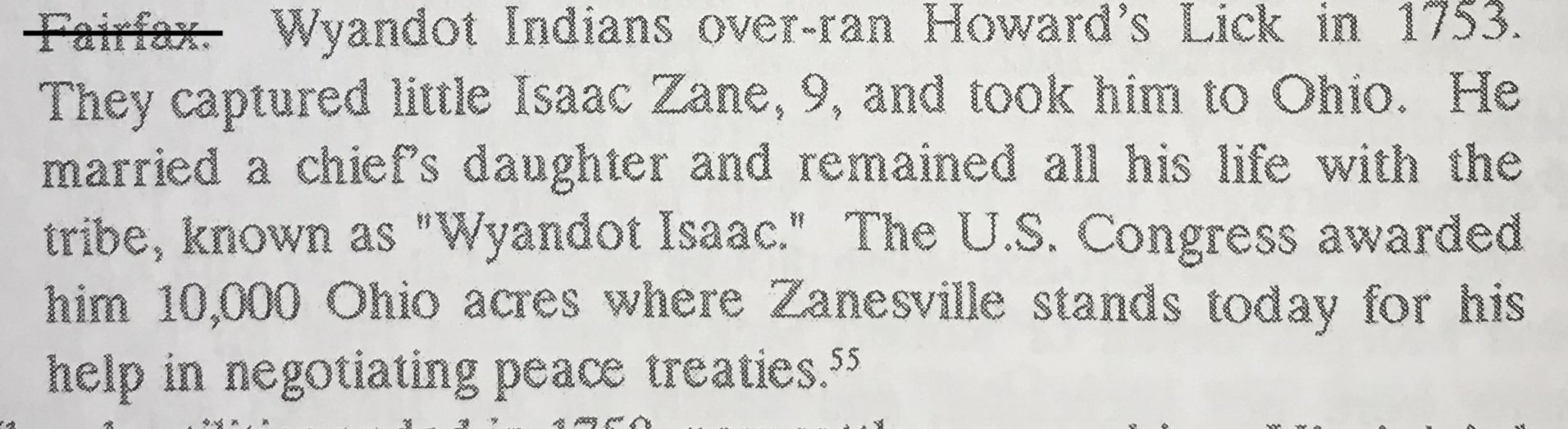
Another, much more intriguing, story about the Quaker Zanes that Worrall recounts is about an event that occurred when the family was still living on the South Branch of the Potomac, in the Shenandoah Valley– near today’s Petersburg, West Virginia. Ebenezer was 6. His parents had been founding members of a little Quaker community there called Howard’s Lick. Worrall tells us (p.162) that this happened to his older brother:
I picked out the above strands from the two books by Jay Worrall and John Hrastar in order to demonstrate that Quakers from the BYM community had been active participants in (and privileged beneficiaries of) the racist, land-grabbing, expansionist settler-colonial project in Turtle Island throughout the whole period from 1655 through BYM’s founding of its “Indian Affairs Committee” in 1795.
I also want to note that Jay Worrall’s book, Friendly Virginians, does a good job of describing how the Quakers in Virginia came over time to grapple hard with the institution of slavery in which, in their early decades in Turtle Island, many of them had participated and from which, of course, they had profited a lot… And how then, over time, many of them came to question its moral underpinnings and sought to dissociate themselves from it.
However. One of the main techniques many of those Quakers used to end their involvement in the slavery system was to up stakes and move off westward where it was easier to make a living that did not rely on the ghastly hyper-profits from slavery. As Worrall described it (p.265), “Ohio fever” seized many parts of Virginia’s Quaker community: “With the Indians subdued, all Virginia was buzzing with talk about the rich new country north and west of the Ohio River. By 1800 thousands of Virginia families had already moved west… [W]hen the Ohio country opened up to the northwest it drew Quakers of Virginia, the Carolinas, and Georgia like iron to the magnet.”
So: Quakers from the U.S. south were so troubled by the institution of slavery that they sought to end their involvement in it. But they did so in a manner that contributed mightily to the infliction of grave harm on ever-increasing numbers of Native Americans.
That troubled me about Jay Worrall’s narrative when I first read it. It troubles me even more today.