1568 was a pretty busy year. And I snuck a quick peek ahead at 1570, which is also action-packed. But 1569? Not so much. Setting aside the perennially fractious French, a little English-Scottish thing continuing, and all the items I usually do set aside anyway, today’s theme will be… geography!
But first, a newsflash, since 1569 CE was the year in which the Russians and the Ottoman Turks engaged in the first of no fewer that twelve wars their nations would fight between then and World War I. And indeed, over the past decade, the two powers have sparred against each other, sometimes very heavily, inside Syria.(Geography has always a factor in their relations, of course.)
This Russian-Turkish War of 1569 was over Astrakhan, which is written in Russian script as Xacitarxan.
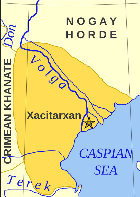
… The Astrakhan Khanate was one of the many little remnants of the formerly grand Mongol Empire, perched on the northwest coast of the Caspian Sea, at a key crossroads of international trade and travel. It had been founded by a Tatar, Mahmud bin Küchük in the 1460s.
In 1556, in Ivan the Terrible’s continuing push to expand his empire, he had pushed down to Astrakhan, building a new fortress on a hill overlooking the Volga. But Istanbul’s Grand Vizier, Sokollu Mehmed Pasha, also had his eye on this strategically located terrain terrain. English-WP tells us: “In the summer of 1569… the Ottoman Empire sent a large force under Kasim Paşa of 20,000 Turks and 50,000 [apparently Crimean] Tatars to lay siege to Astrakhan. Meanwhile an Ottoman fleet besieged Azov.”

Worth noting that Azov is at least 300 miles away from Astrakhan, across presumably mountainous Caucasian terrain. So the Ottomans’ ability to manage all this back in those days looks pretty impressive?
Anyway, in Astrakhan, the Russians drove back the besiegers. English-WP: “On their way home up to 70% of the remaining soldiers and workers froze to death in the steppes or became victims of attacks by Circassians. The Ottoman fleet was destroyed by a storm.” (I’m guessing that would have been the Black Sea fleet, over in Azov?)
However, though it was defeated militarily, “the Ottoman Empire achieved safe passage for Muslim pilgrims and traders from Central Asia and the destruction of the Russian fort on the Terek River.”
A first note on world geography
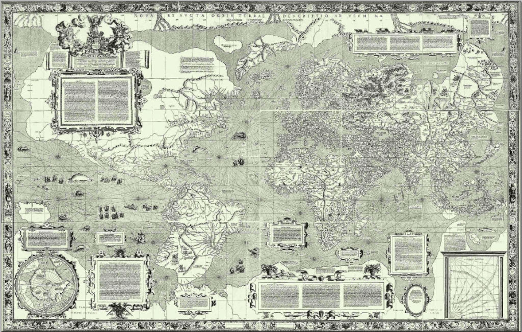
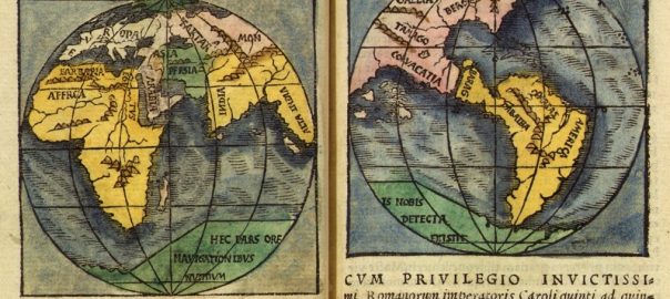
This note was provoked by the fact that 1569 was the year that Gerardus Mercator published his first world map using the new method of projection that would be named after him. (By the way, the map at the very head of this page is a pre-Mercator map of the world, produced by Monachus in 1527.)
If you’re interested in maps, that whole English-WP page on him is really interesting. (It contains a very sweet short video with English sub-titles explaining how the Mercator projection is conceived of and calculated.) One thing I learned from the WP page is that as a young man, in 1537, the very first map he made– one that was West-facing– was of Palestine (“The Holy Land”.) Wow, that European fascination with Zion was already such a powerful thing.
Map-making was of course– along with shipbuilding, gunmaking, navigation, and the ability to raise finances– one of the technologies essential for the creation and maintenance of world empires. It became a big thing in the 15th and 16th centuries in Antwerp, where Mercator was born, and in the rest of the Low Countries. Another key technology, by the way, was the detailed kind of navigational knowledge contained in “Rutters”, which were the records each conquistador made of each of his voyages, containing vital information on tides, winds, how to approach each port, the location of shoals, etc. The information contained in the Rutters was very closely held, and was one of the main reasons that master mariners were so widely sought after by financiers and others eager to get into on the empire-building game.

Anyway, one of the main things I’ve been wanting to do with this project is to delve a little deeper into the matter of why it was that a handful of European polities– all of them located on the continent’s Western (Atlantic) seaboard– became able, in the period from 1415 CE through let’s say 1915 CE, to build up their series of globe-girdling empires.
As we’ve seen in this project so far, it was Portugal and Spain that led the way– often using skills they’d honed during the centuries-long wars they’d fought against the once well-entrenched Muslim city states in Iberia. (I write “Portugal and Spain”, though of course it was more like, “Portugal, Castile, and Aragon.”) And then later, England (later Britain), France, and Netherlands all followed along. During the exact same period those polities were crystallizing into the “nation-states” we came to know more recently, they were also building– and reaping massive super-profits from– their global empires. But all five of those powers had a lot in common. It wasn’t just being “Christian” powers located along Europe’s Western seaboard. It was also the fact that they all had or developed well-honed militaries capable of fighting both by land and by sea. And as we have seen, during the 16th century, all of them except Portugal had been doing a lot of fighting (by land and sea) against each other and internally– and interfering massively in each other’s affairs– within their European home-continent and its waters. To some extent, their development of rival world empires could perhaps be seen an extension of that intra-European fighting, just carried over to the distant shores of Brazil, “Mexico, “La Florida”, or wherever.
I think the reason the Portuguese were not involved so much in those 16th-century battles inside Europe was probably because Portuguese conquistadores were all so very busy all around the coast of Africa and the shores of the Indian Ocean, making, developing, and protecting their very lucrative trading routes; and the Portuguese Kings and their administrations were presumably busy doing some coordination of that; and “Portugal” had kind of developed a sense of itself as a distinct polity with boundaries that were little challenged by anyone… And all three of those things went together.
(Soon, I know, in 1580 or so, Portugal and Spain are about to be joined into an “Iberian Union,” that will interrupt my picture of Portuguese domestic/territorial tranquillity a little. But I can assure you it won’t last very long.)
But meantime, here we were in 1569-70, with terrible genocides continuing to be committed in the Americas, primarily by the Spanish; with the world’s first global pandemic having already put in an appearance; and with England and France having taken their first steps into the venture of world domination… There are other significant empires in other continents around the world, yes. Primarily, the Ottoman, Mughal, Ming-Chinese, and perhaps the Russian empires. What will happen to them under the impact of the European imperialisms soon to come? Stay tuned…